Lenght of this section: 16.8 miles
Altitude drop over this section: 55 feet
I paddled this section on June 21, 2018, Summer solstice day (16.8 miles). Not a cloud in the sky and the sun was really beating down on me. I was wearing shorts, and although I had put on a lot of sunscreen I could really start to feel my legs being burned. Fortunately, I had packed a pair of lightweight long pants and I got out of the river and put them on. Before the sun got too high parts of the left hand bank offered shade and I paddled close to shore seeking relief. But, eventually as the sun rose higher overhead there was very little shade. I had brought along a lot of water that I had kept cold in my cooler and that offered me a lot of relief.
Despite the burning sun, this was the best section of the river so far. This is where the river starts to flow thru the Endless mountains of PA. The scenery is great and there are several sections of fast flowing water that makes for a fun ride.
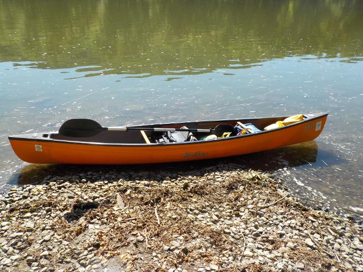
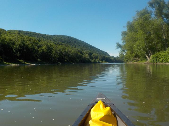
My new boat. until this trip I had been using a red Dagger kayak that I purchased about 12 years ago, before kayaks became popular. The Dagger has served me well, but on the last couple of trips I started thinking that I want something a little wider and more roomy. I did some research and found that Next makes a small canoe that seems to fit my specs. It just so happened that Narrow River kayak rental in Narragansett RI (where I have a small summer home) had a used one for sale and I bought it.
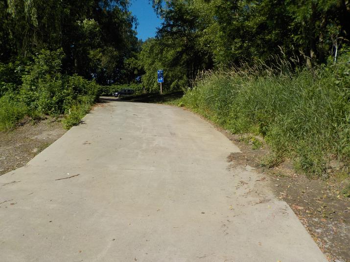
I started out at 9:20 AM from the Riverfront Park boat ramp in Sayre PA where I had paddle up to on my last trip.
About 10 minutes later the Susquehanna St. bridge in Athens PA comes into view, and I passed under it at 9:36. 16 minutes after leaving the boat ramp.
Soon after going under the bridge the river splits and I decided to take the left branch. But if I had to do it again I would take the right branch. The left branch was slow going and I actually dragged bottom a few times. Also, I completely missed the merging of the Chemung river with the Susquehanna. The Chemung is a major tributary of the Susquehanna and historically important (more on this in the area history section).
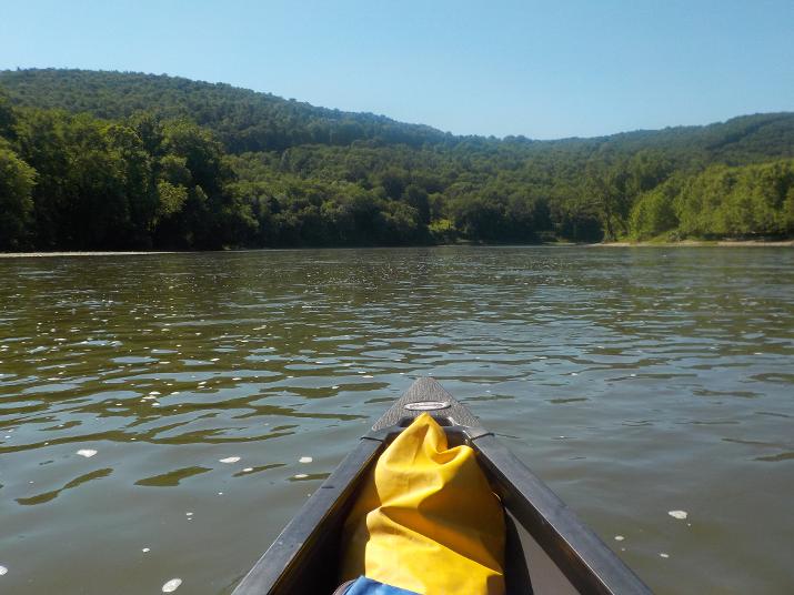
Just a view of the river. As you can see the river narrows up ahead. When that happens the water speeds up as more volume is confined into a smaller space.
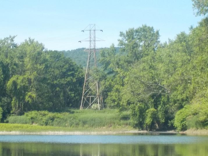
I reached this set of powerlines at 10:30. One hour and 10 minutes into the trip.
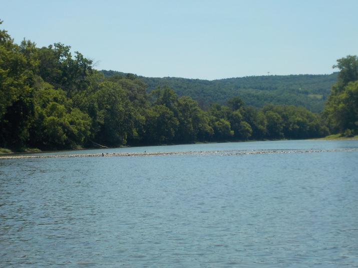
A sandbar almost completely blocks the river. I paddled to the right hand side and dragged bottom. Even this far down river the Susquehanna can be very shallow; despite the fact that it has been a wet summer.
Around this time I spotted a Bald eagle, but by the time I got my camera ready it took off into the forest and disappeared . I had not seen one since about two years ago and I was wondering if something changed. About three and four years ago while paddling the NY section of the river I saw many and took photos. They did not seem to be afraid and I could get as close as 200 feet.
The Bridge St bridge at Ulster came into view at 11:55 and I passed under it at 12:10. Just before the bridge, on the right is an easily accessed boat ramp. If traveling south on route 220 take a left onto Bridge st, . and just before the bridge on the left you will see a ramp going down to a parking lot. That's the river access.
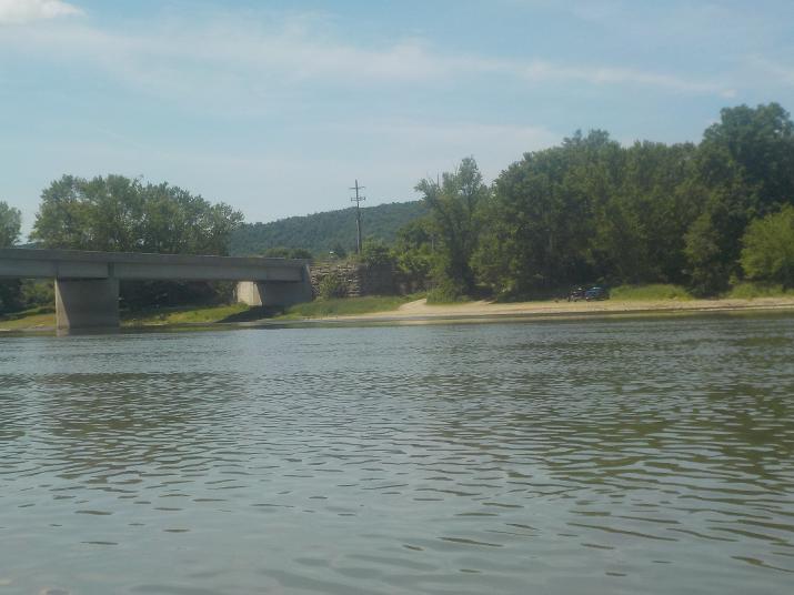
The river access and boat ramp at Bridge St. in Ulster PA. After this point the river bank became more populated with year round homes and I could hear a lawnmower from time to time. At around 1:00 I took a lunch break and got back on the river at 1:40.
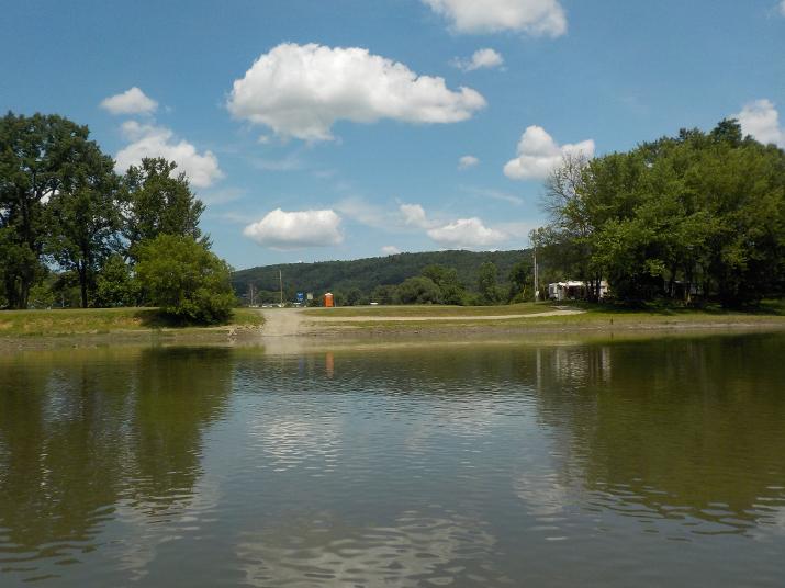
Ten minutes after getting back in the river I reached Hornbrook park and campground in the northern fringes of Towanda PA. I reached it at 1:55 . When subtracting 40 minutes of my lunch break it means that it took me about 4 hours of paddling to get to this point.
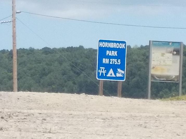
275.5 miles to the Chesapeake bay. This means that up to this point I have paddled 169.5 miles
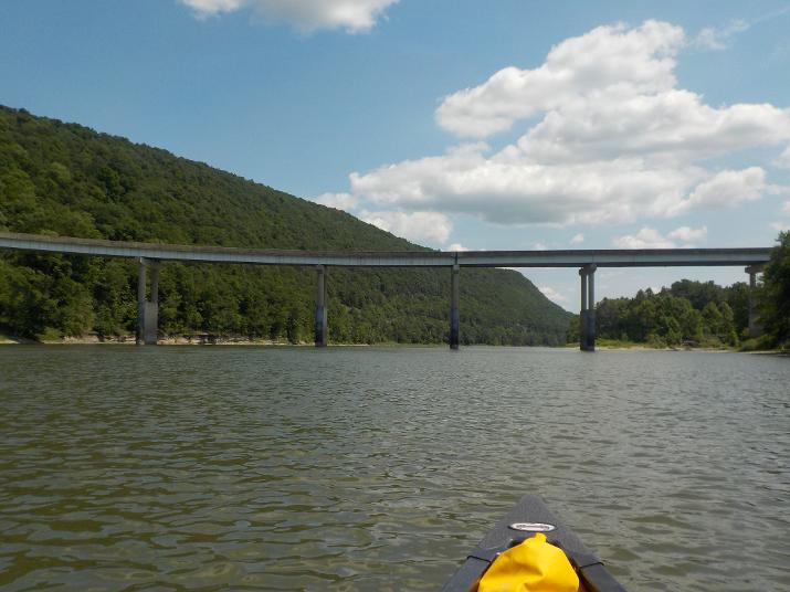
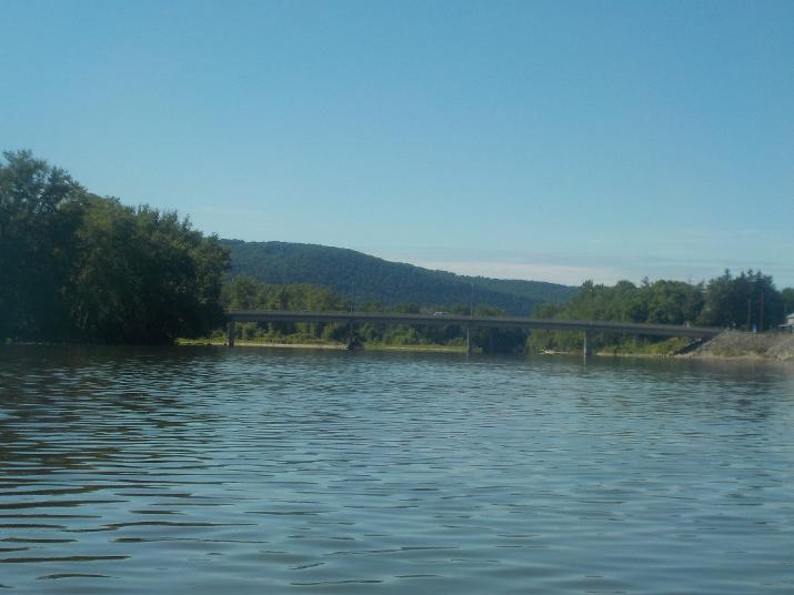
At 2:30, 35 minutes after Hornbrook Park the James St. bridge in Towanda comes into view and I pass under it 10 minutes later. This bridge is distinctive because it curves from one bank to the other instead of just cutting straight across. I do not know if this is because of some engineering need or for architectural esthetics. But, so far this is the only bridge I have seen that curves in such a way
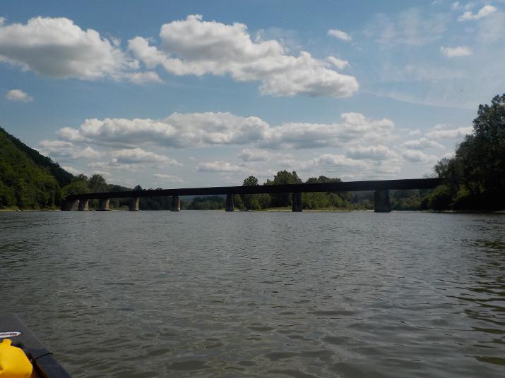
As soon as I went under the James St. bridge another bridge came into view and I went under it at 3:00. As I got close I could see that it was a railroad bridge and it too was curved. I am not sure if this bridge is still in use. I do not think so.
As I approached I could hear the sound of a waterfall and I could see the speed of the river picking up. I stayed on the right side by lucky coincidence and as I passed under the bridge I could see that on the left side the river tumbled over some obstruction about 2 feet high. High enough to cause a spill. So, when approaching the bridge stay on the far right side.
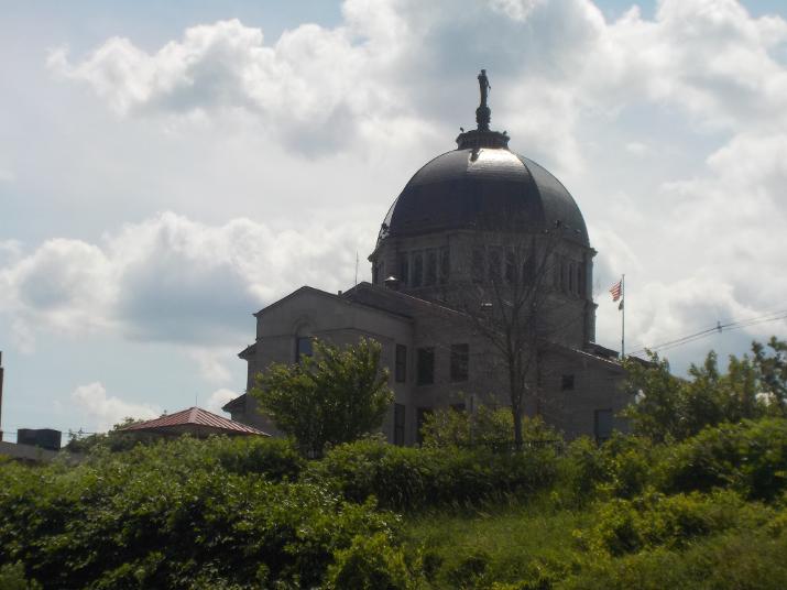
Right after going under the bridge this imposing structure can be seen on the right bank. I believe this is a Greek Orthodox church along the main street in the downtown area of Towanda. A few years ago Towanda created a 1.5 mile river walk along this stretch and near the end of it there is a river access ramp; that was my objective for the day. From this point I still had about 1.3 miles to go.
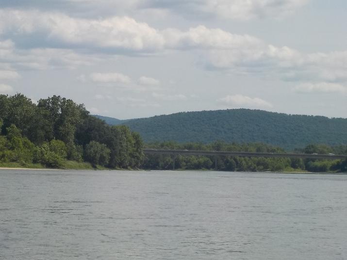
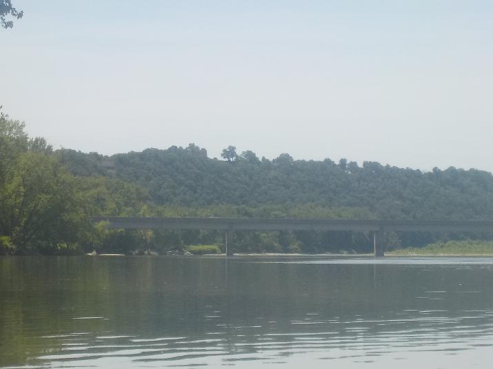
Way off in the distance the Route 6 bridge in Towanda could be seen. The boat ramp is before the bridge. The photo above makes the bridge look closer than it is; I must have zoomed in a bit when I took the picture. I still had about 1.3 miles to go and by then I was really tired. With the exception of the 40 minute lunch break I had been sitting in the kayak for 6 hours. The temperature had been rising all day and the sun was beating down on me sapping my energy. My back, legs, and arms hurt and I kept changing my position which provided some short lived relief.
Finally at 3:10 I reached the Towanda river access ramp. It took me 5 hours and 50 minutes to make the trip from Sayre to Towanda. Minus 40 minute lunch break, I paddled the section in 5 hours and 10 minutes. The distance marker at this point shows 271 miles to the Atlantic ocean. This means that up to this point I have paddled 173 miles.
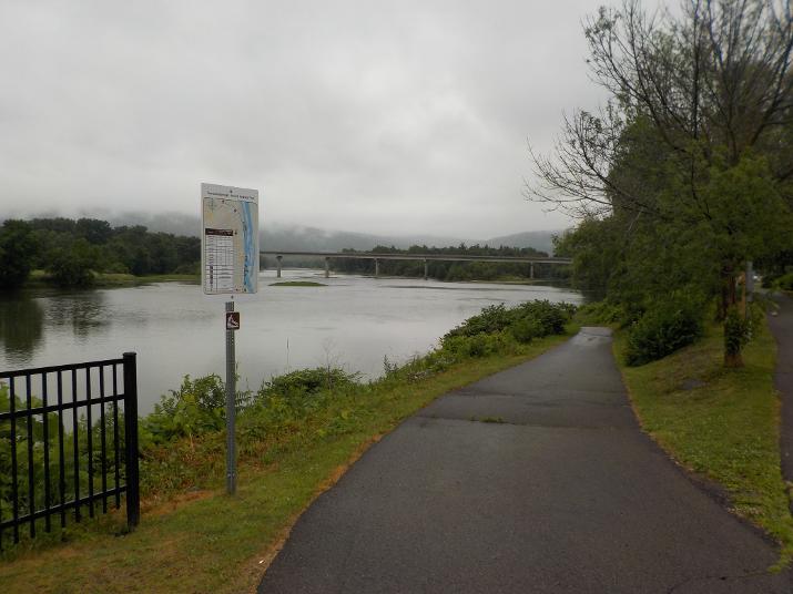
You can see the route 6 bridge in the background. I would be going under that bridge on my next trip. The boat ramp leads up to the River walk (a 1.5 mile walkway with the Susquehanna river on one side and the downtown section of Towanda on the other. A great place to walk, but not a very good place to exit or enter the river as it is a pretty busy area with few available parking spots.
I did not know it at the time, but across the river on the left bank there is a much better place to exit and enter the river; The Eastside Riverfront Park. This area offers parking and a less steep boat ramp. On my next trip (Towanda to Sugar Run) I used the Eastside Riverfront park as my starting point. To get to the Eastside Riverfront park from the north: Drive thru Towanda along Main St, (Rt. 6). Follow the signs for Rt. 6 south and drive across the river on the Rt 6 bridge. Take the very first left as soon as crossing the bridge. Follow the road to the Eastside Riverfront park.
My brother picked me up, we loaded my kayak on his pick up and he drove me back to Sayre to pick up my car. Then, off to his cabin for a well deserved beer.
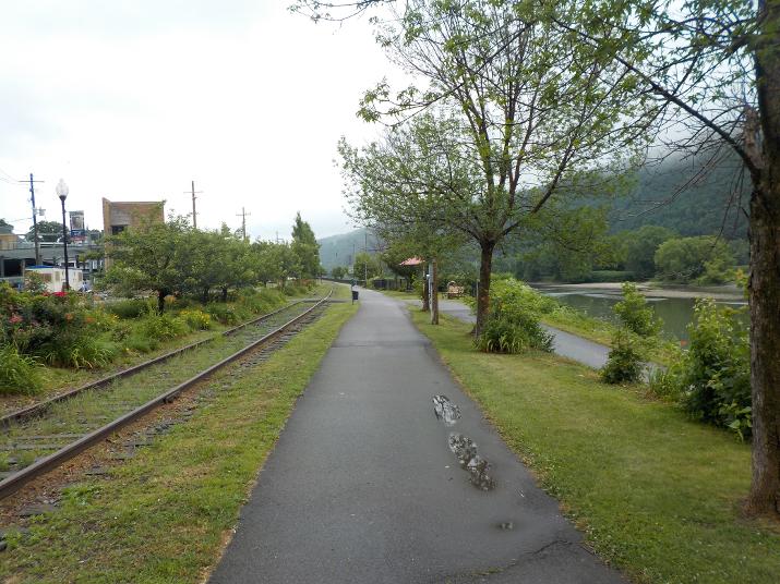
A partial view of the riverwalk
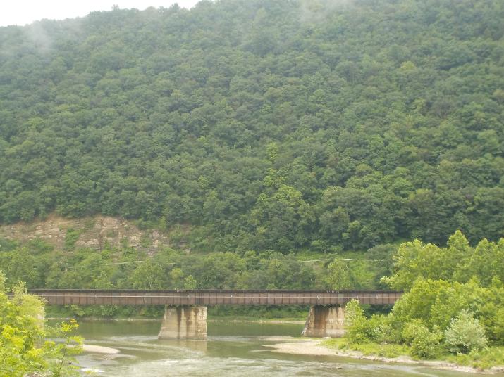
A view of the railroad bridge from the northernmost point of the Riverwalk. I passed under this bridge about 11 minutes before reaching the boatramp.