A short history of the island:
Hiawatha island is 112 acres and t is the largest island on the river within New York state. In the 1870's a hotel was built on it and the island was almost completely cleared of trees. At first the hotel was a two story structure, but later a 3rd and 4th floor were added along with a ballroom for dancing and dining. It was a popular destination for day trips from Owego to Binghamton.
The hotel closed in 1895 and it became the home of the Goodrich family until 1930. After that most of the buildings were dismantled or burned down and today only two buildings remain.
Exploring the island:
Last year, when I paddled the Apalachin NY to Nichols NY section I passed by Hiawatha Island. I had planned to explore the island at that time, but I was making slow progress due to the low water flow and slow current, and decided to make a special exploration trip at some future time. So, on May 9, 2018 I set out from my home in Massachusetts early in the morning and after a little more than 5 hours of driving I reached the Town of Owego NY boat ramp located on Marshland Rd. The boat ramp is directly across from the island and is the easiest way to get to it. But, a more fun adventure is to start out at the Apalachin NY boat ramp upstream and paddle down to the island and back. When I paddled that section last year it took me about 2 hours to go from Apalachin to the southernmost tip of the island. But, keep in mind that I stop often to take pictures and make notes, and the current was very slow on that particular day. If one is concentrating on just paddling the time would likely be half as much. This section of the river (from Apalachin to Hiawatha) is deep and lake-like. So you will be able to paddle to the island and back. But, this is not 100% guaranteed. If the water level is high and the current fast a paddler may have a difficult time on the way back.
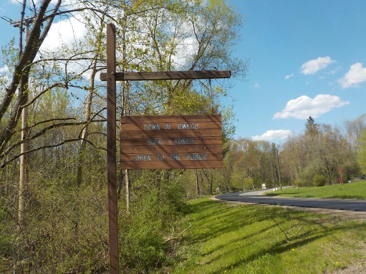
The Owego boat-ramp is a bit tricky to find. the best access is from RT 17. I was traveling west and got off the highway at exit 65, go left at the end of the ramp and travel on the overpass (over Rt. 17). The overpass dead-ends at Rt. 434 and there is a sign that shows Rt 434 east and west. Go east and travel parallel to Rt. 17 east for about one mile and then take a left on Marshland rd. The boat-ramp is a quarter mile or less on the left. You will see this sign (above).
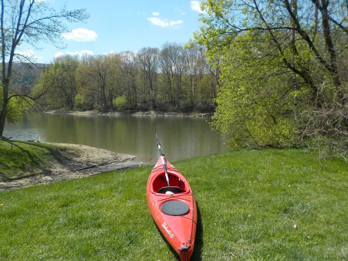
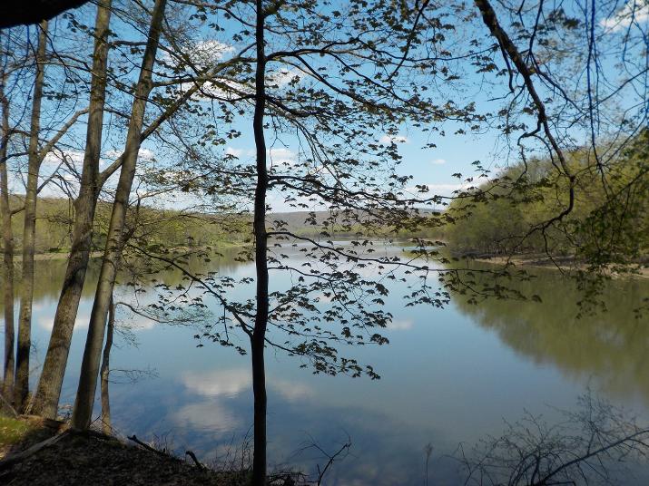
As you can see from the picture above, Hiawatha is a short distance from the boat-ramp. I did not know it at the time, but the most interesting part of the island is found on the downstream end. Also, the shore line at that end is flat and the best place to land. But, I simply paddled a few strokes directly across the boat-ramp where I found a fallen tree that offered me a convenient place to land (see below).

The river bank at this spot is steep and about 20 feet high and I had to scramble to make it up to the flat ground.
I did not see anything of interest and decided to walk in the downstream direction on what looked like a small trail.
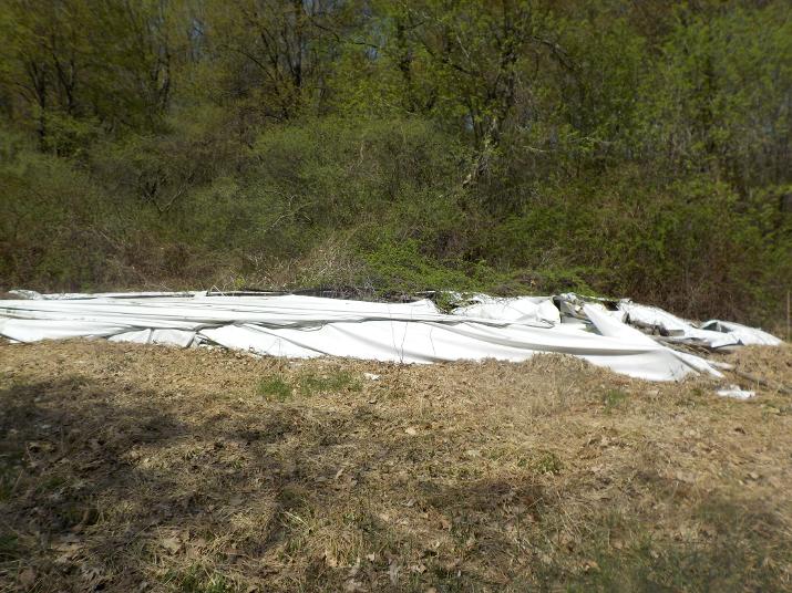
The trail led to a small clearing where I found a collapsed pile of branches and plastic tarp that I surmised to be a garden shack that at one time might have held gardening equipment. There was also an old rusting riding mower in the clearing. The trail did not continue from that spot. and I decided to retrace my steps back to where I landed and then continued upstream along the trail. I did not see much of interest on the upstream side. But, here are a few photos
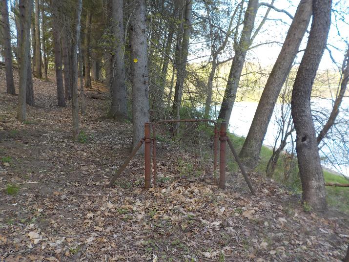
A gate to nowhere
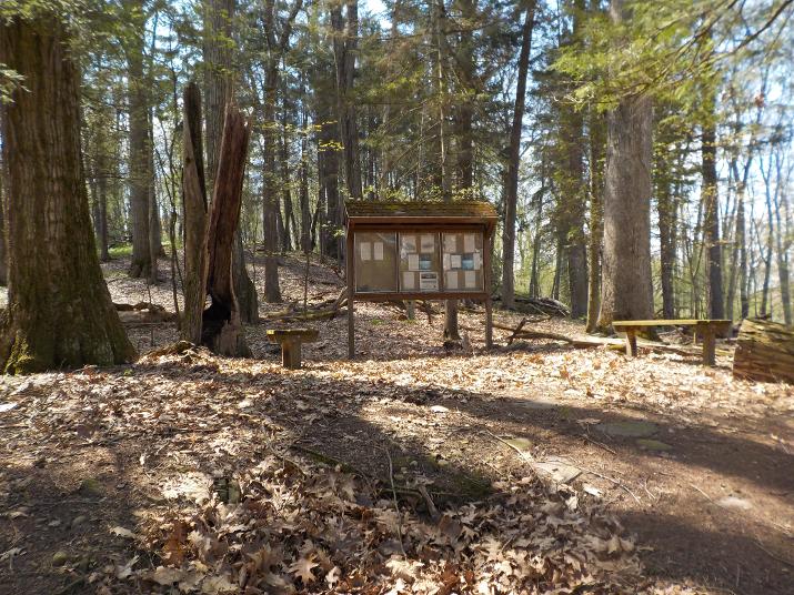
An information shelter that told the story of the Island. And,showed drawings of the hotel that once occupied the island in the 1800's and of the steam boat that brought visitors from Binghampton
I walked to the end of the upstream side of the island and by then I was a bit disappointed at not having found anything substantial. A couple of years ago I was told by a couple of paddlers that the island had a lot of old-time artifacts (foundations, very old tractors, trucks and cars) that were left behind when the island was abandoned. But I had explored only about a third of the island, so I kept going.
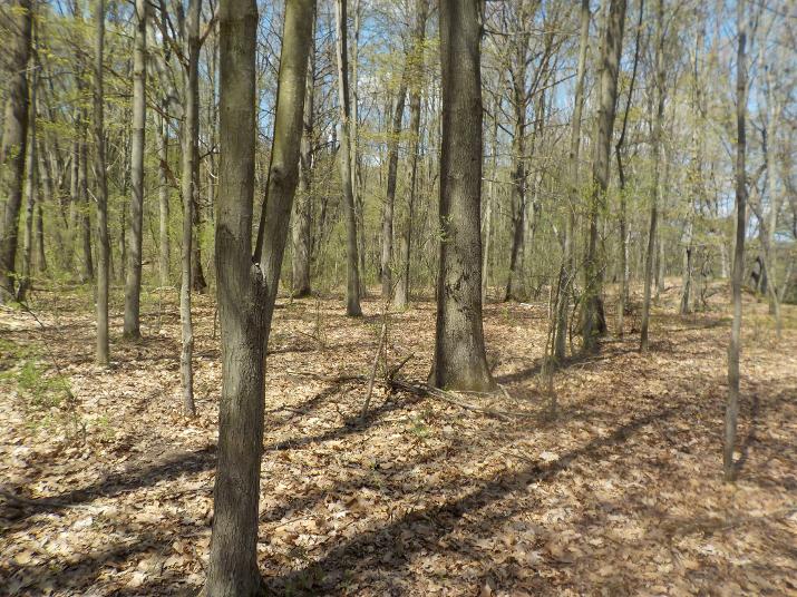
I left the path and walked uphill thru the middle of the island walking in the opposite direction that I had come, but not along the shore as I had done earlier. The middle of the island is a hill that I estimate to be about 50 feet above the river.
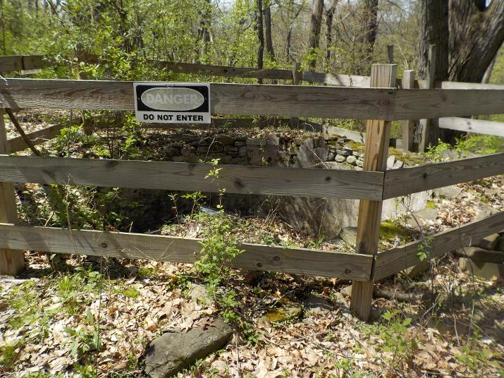
At the very top of the hill I came across what I'm guessing was a cistern that held water. I doubt if the water was from a spring because I did not see any possible source. Most likely the water was transported or pumpedto the cistern, stored there, and from there gravity took it to where it was needed.
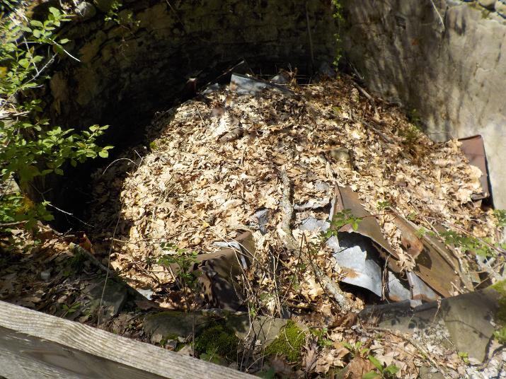
Inside the cistern,
I then continued walking towards the downstream side of the island; still on top of the hill, and after a short walk I came to the downward slope where, looking down I saw some buildings and old vehicles.
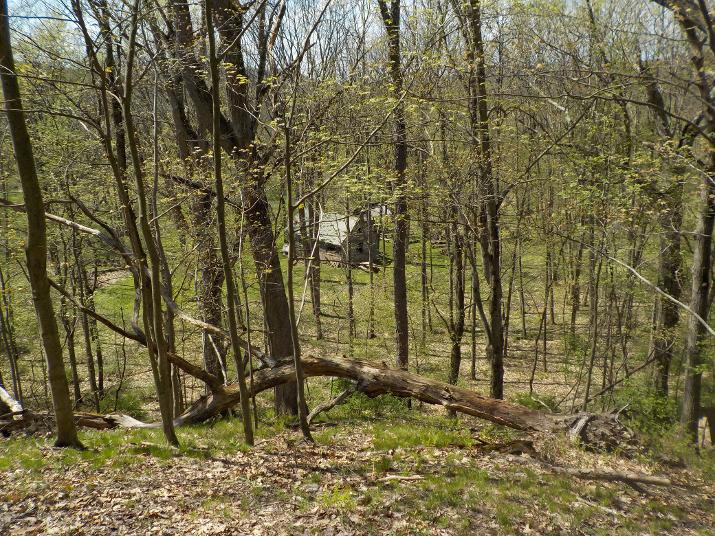
View from the top of the hill looking down towards the downstream side of the island.
I walked down the hill to the bottom.
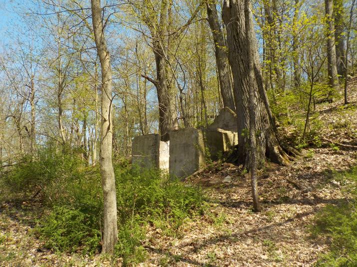
This foundation was on the side of the hill near the bottom.
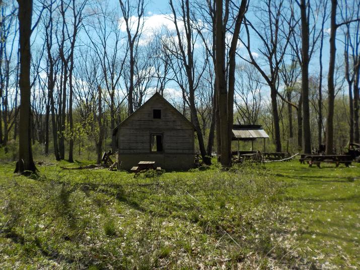
As I approached the barn I could see right thru it and for a split second I saw a large animal run across the opening on the other side. My immediate thought was that it must be a deer, but it looked darker than a deer. A bear, maybe? That thought frightened me a bit. The few times that I have encountered bears, primarily at my family's land in PA, they have always turned tail and run off. But here I am on a fairly small island with little resources; especially in early May when there is little to eat. And what if its a female with cubs?
Black bear is the name of the species that is found in the northeast US (but actually their color ranges from jet black to a kind of blond (cinnamon)). They are much smaller than the Brown bears found in the western US, but Black bears can get to be 600 pounds or more. and 300 pound Black bears are not at all uncommon. I looked around for a nice sturdy stick. You would think that it would not be hard to find a stick in the woods, but most of them were rotted and bridle. Finally I found a sturdy one; about 6 feet long and about 2 inches in diameter. Made me feel a bit more secure.
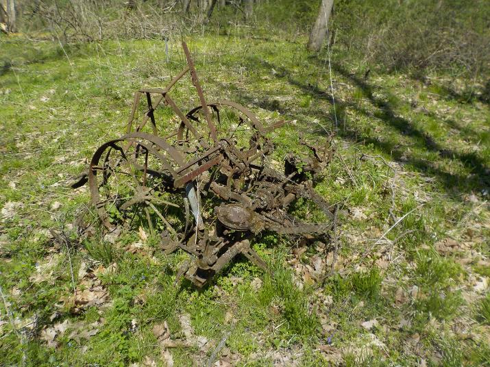
Old farm equipment. I don't know what it is.
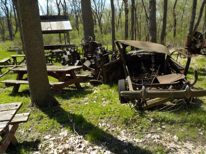
Old vehicles. 1930's? 1940'S?
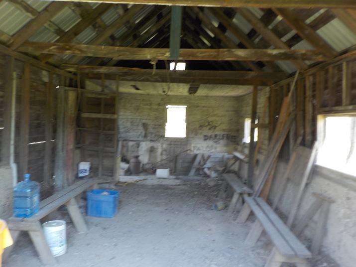
Inside the barn
When I walked in I heard a thud in the loft above my head. I was already on my guard because of the possible bear sighting outside and the noise startled me. But, I quickly determined that the noise was made by an animal bigger than a squirrel but smaller than a human or a bear. something about the size of a racoon or a porcupine. I thought it interesting that when the senses are sharp our brain is capable of creating a mental picture even from our sense of hearing.
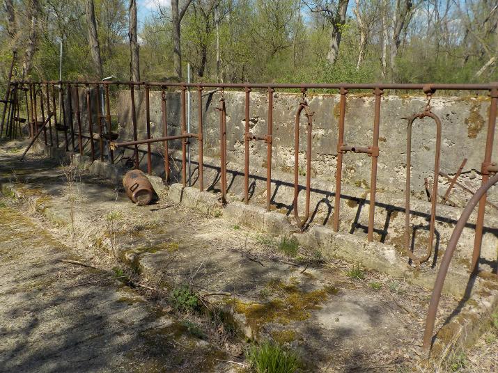
In the same area where the barn and old vehicles were located there was also the foundation of a milking shed. Apparently there had been farming on the island. There was also an information board that told visitors about the farming activity.
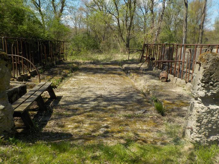
Note the ruts in the picture above. I assume that these were used to channel the cow dung and then washed out of the shed. Guess were the ruts led; right into the river. At one time the Susquehanna must have smelled pretty bad considering all the farm run off that used to take place.
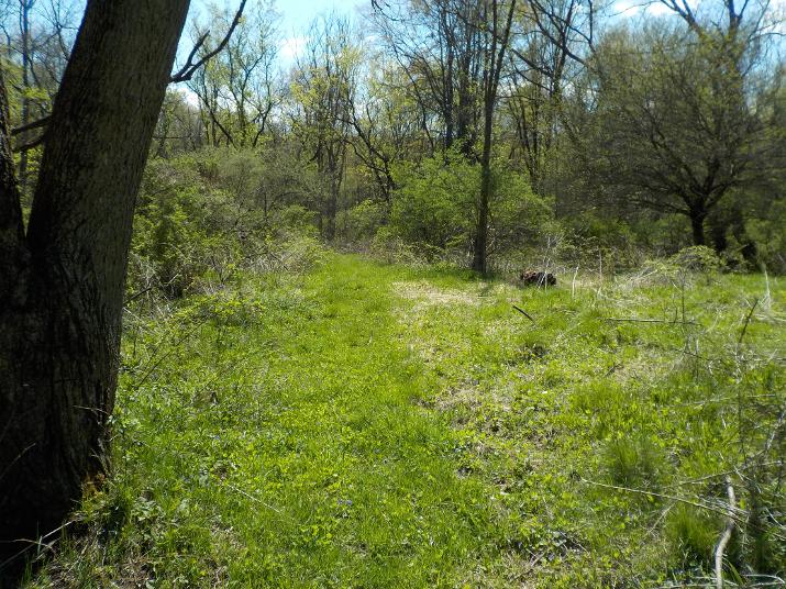
Past the milking shed I notice a grassy path and decided to follow it. I was a bit apprehensive because that is the direction in which the large animal had gone. I noticed then that the island contains several hiking trails that are marked by different colored disks that are affixed to trees. this particular trail followed the river bank and headed in the direction to where I had left my kayak. after walking a couple hundred feet I saw a large deer. I am pretty sure that the deer is what I had seen earlier. That makes a lot more sense than a bear. I doubt if the island could support the needs of a bear.
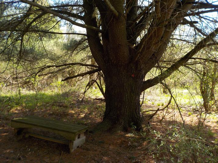
A bench on the trail: The island is maintained by volunteers and I think they do a good job considering that the island is not easy to get to and any equipment and tools have to be brought over by boat. But, I also observed a lot of graffiti and some vandalism. I imagine that the volunteers take care of it from time to time, but unfortunately it is difficult to keep up with vandals.
I continued walking along the trail and it brought me back to where I had left the kayak and paddled back to the boat ramp.